


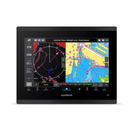
Garmin GPSMAP 9217 Multifunction Display
$4,354.00
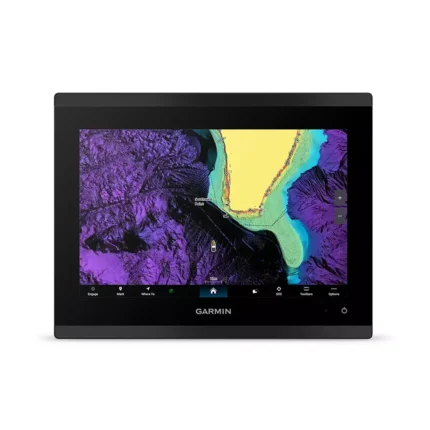
Garmin GPSMAP 9217 Multifunction Display is a 17.25-inch 4K IPS helm display with Mini LED local dimming, preloaded Garmin Navionics+ mapping, and Garmin BlueNet networking. It is built for larger glass helm layouts that need chart detail, screen space, and fast system response.
100 in stock
Description
Overview Garmin GPSMAP 9217 Multifunction Display
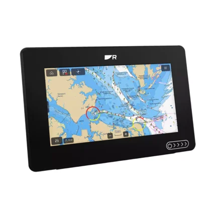
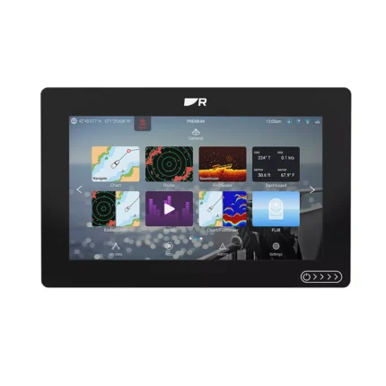
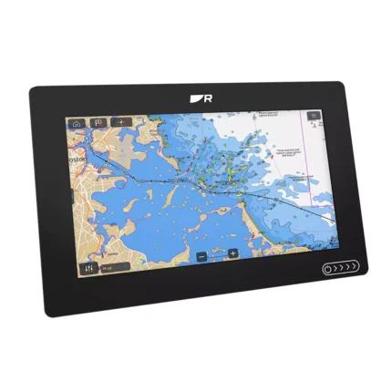
Garmin GPSMAP 9217 Multifunction Display is a large-format 17.25-inch helm display designed for vessels that want a 4K primary screen with integrated chart coverage. The IPS panel uses 3840 x 2160 resolution with Mini LED local dimming, giving more room for charting, split-screen layouts, radar, and networked data.
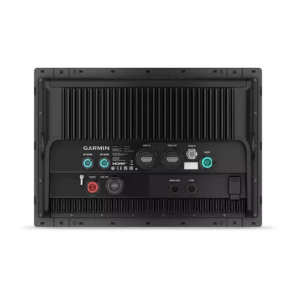
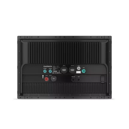
This version includes preloaded Garmin Navionics+ mapping and uses the updated Garmin platform listed in the source as 7 times faster than previous generations. Garmin BlueNet enables high-speed network communication, while the built-in 10 Hz multi-band GNSS receiver and broad connectivity options support larger integrated helm systems.
Key Features
- 17.25-inch 4K IPS display: Provides a large working surface for chart navigation and multi-window operation.
- Mini LED local dimming: Helps improve contrast and visibility for chart and system data across changing light conditions.
- Preloaded Garmin Navionics+ mapping: Adds onboard chart coverage for immediate route planning and navigation use.
- 7x faster processing platform: Supports quicker response during chart redraws, zooming, and general system control.
- Garmin BlueNet networking: Supports fast sharing of compatible radar, cameras, displays, and other helm data.
Applications
Well suited to larger cruising, offshore, and sportfishing helms that need one large display with charting already included.
A strong choice for Garmin glass helm layouts where high-resolution screen area and fast networking matter across multiple devices.
Specifications
| Display size | 17.25 inches diagonal |
| Display resolution | 4K 3840 x 2160 pixels |
| Processor speed | 7x faster than previous generations |
| Display type | IPS with Mini LED (local dimming) |
| Mapping | Preloaded Garmin Navionics+ |
| Networking | Garmin BlueNet (gigabit speeds) |
| Internal GPS | 10 Hz multi-band / multi-constellation |
| Connectivity | NMEA 2000, J1939, USB-C, Wi-Fi, ANT |
| Waterproof rating | IPX7 |
| Weight | 13.0 lbs (5.9 kg) |
What’s Included
- Garmin GPSMAP 9217 Premium Chartplotter
- Garmin Navionics+™ Mapping (Preloaded)
- Power Cable and NMEA 2000® T-connector
- NMEA 2000 Backbone/Drop Cable (2 meters)
- Flush Mount Kit and Protective Cover
- Trim Piece Snap Covers
- Comprehensive Documentation Pack
Reviews (0)
FAQ
Frequently Asked Questions About Garmin GPSMAP 9217 Multifunction Display
What is the Garmin GPSMAP 9217 Multifunction Display designed for?
The Garmin GPSMAP 9217 Multifunction Display is designed for larger cruising, offshore, and sportfishing helms that need one large display with charting already included. It also works well in Garmin glass helm layouts where high-resolution screen area and fast networking matter across multiple devices.
What key features does this display offer?
This display combines a 17.25-inch 4K 3840 x 2160 pixels screen with Preloaded Garmin Navionics+ and a platform described in the source data as 7x faster than previous generations. Together with Garmin BlueNet and a 10 Hz multi-band / multi-constellation receiver, it is built to keep charting and helm integration responsive.
Is this display suitable for clear helm viewing?
Yes. The screen uses 4K 3840 x 2160 pixels with IPS with Mini LED (local dimming), which helps present chart, radar, sonar, and split-screen data with higher detail. That larger, high-resolution format is useful on helms that need clearer separation between multiple onboard data views.
What networking and integration options are available?
The unit supports Garmin BlueNet (gigabit speeds), NMEA 2000, J1939, USB-C, Wi-Fi, ANT, and a 10 Hz multi-band / multi-constellation receiver for broader bridge integration. This makes it suitable for installations that need charting, connected vessel systems, and fast data sharing through one primary display.
Shipping and Delivery


Reviews
There are no reviews yet.